78,720 €
Agricultural land Santu Lussurgiu, Oristano (province)
Description
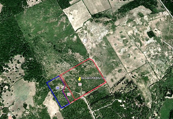
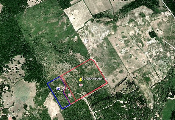
Plot of land, located in the area of “Su Laccheddu Ruju”, in the Municipality of Santu Lussurgiu (OR), approximately 150 km from the regional capital, Cagliari, and approximately 45 km from Oristano, with a total area of approximately 78,480 square meters. The entire lot in question, following a variation of the current urban planning tool, has changed the urban destination (Urban Destination Certificate of 11.04.2024), falling within "Zone E2 agricultural", regulated by articles 22 and 24.
Located approximately 6 km from the town center, the entire property is located less than 800 m above sea level, in an area called “S. Leonardo” renowned for the excellent quality of spring waters, at a distance of approximately 17 km in a straight line from the sea.
The area on which the property stands is entirely fenced with barbed wire supported by concrete posts. Access is permitted through a metal gate. The land has a slightly flat topography, in some places hilly and weakly sloping, uncultivated, with shrub vegetation and the presence of defects consisting of outcrops of volcanic rocks. Within the context, there are wooded areas with holm oaks and oaks, yews and undergrowth.
The lot is part of a larger area, extending approximately 37.47.65 Ha, within which a well is identified, located in parcel 26 of another property, for the extraction of mineral resources, by virtue of a temporary concession for the cultivation of mineral water, named “Su Laccheddu Ruju”, in the countryside of the Municipality of Santu Lussurgiu (OR), CURRENTLY INACTIVE.
This text has been automatically translated using AI.
Details
- Property Type
- Agricultural land
- Condition
- N/A
- Living area
- 0 m²
- Energy Efficiency Rating
- Reference
- Terreno a Santu Lussurgiu
Distance from:
Distances are calculated in a straight line
Information about Santu Lussurgiu
- Elevation
- 503 m a.s.l.
- Total area
- 99.7954 km²
- Landform
- Inland hill
- Population
- 2179
Map
The property is located within the highlighted Municipality.
The advertiser has chosen not to show the exact location of this property.
Google Satellite View©
Contact Agent

Rete Aste Srl
Scali d'Azeglio, 2/6, Livorno, Livorno
+39 0586 201480
What do you think of this advert’s quality?
Help us improve your Gate-away experience by giving a feedback about this advert.
Please, do not consider the property itself, but only the quality of how it is presented.